La Plata Peak
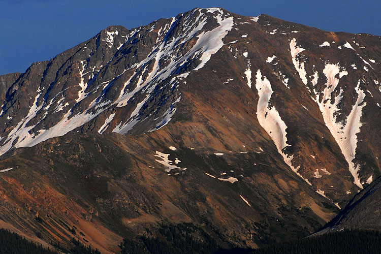
La Plata Peak is the fifth-highest summit of the Rocky Mountains of North America and the U.S. state of Colorado. The prominent 14,343-foot (4,372 m) fourteener is located in the Collegiate Peaks Wilderness of San Isabel National Forest, 22.7 miles (36.5 km) northwest by west (bearing 308°) of the Town of Buena Vista in Chaffee County, Colorado, United States. "La Plata" is Spanish for "The Silver", a reference to the many silver deposits in the area. The nearby ghost towns of Winfield and Hamilton were prominent silver mining towns in the early part of the 20th century. A Hayden Survey team first climbed the peak on July 26, 1873. The elevation of 14,361 feet marked on the USGS Mount Elbert Quadrangle is incorrect, and should read 14,336 feet (in the NGVD 29 vertical datum).
Elevation: 4372 m
Country: United States
Explore topics:
- La Plata Peak hiking routes
- La Plata Peak best routes
- La Plata Peak camping
- La Plata Peak parking
- La Plata Peak car park
- La Plata Peak difficulty
- La Plata Peak family friendly
- La Plata Peak dog friendly
- La Plata Peak sunrise hike
- La Plata Peak sunset hike
Related mountains in United States
- "Leaning South Peak"
- 1117 Mountain
- 1st Burroughs Mountain
- 22 Mesa
- 2768 feet
- 3rd Burroughs Mountain
- 45 Hill
- 7 Mile Point
- 7780 ft
- 7K Peak