Arenig Fach
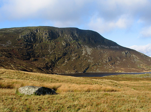
Arenig Fach is a mountain in southern Snowdonia, north Wales. It is a peak in the Arenig range and lies to the north of its parent peak Arenig Fawr. It lies close to Llyn Celyn alongside the A4212 between Trawsfynydd and Bala. Carnedd y Filiast and Foel Goch (Arenigs) is to the east, while Moel Llyfnant, Gallt y Daren and Arenig Fawr are to the south. The summit itself is known as Carnedd Bachgen, named after the ancient cairn, Carnedd y Bachgen (which lies just north-east of the summit), and is the highest point at the north end of a wide plateau. There is a trig point and a substantial shelter cairn. The mountain rises from the Migneint moorland and looks like a bulky heathery "lump" from most directions. However, its north-eastern face has steep cliffs with a small corrie lake, Llyn Arenig Fach, at their bottom. The last glacier occupation of this corrie is thought to have happened during the Loch Lomond Stadial.
Elevation: 689 m
Country: United Kingdom
Explore topics:
- Arenig Fach hiking routes
- Arenig Fach best routes
- Arenig Fach camping
- Arenig Fach parking
- Arenig Fach car park
- Arenig Fach difficulty
- Arenig Fach family friendly
- Arenig Fach dog friendly
- Arenig Fach sunrise hike
- Arenig Fach sunset hike
Related mountains in United Kingdom
- A' Bhuidheanach
- A' Bhuidheanach Bheag
- A' Chailleach
- A' Chailleach
- A' Chaoirnich
- A' Chioch
- A' Chioch
- A' Chrois
- A' Chràileag
- A' Ghlas-bheinn