Mount Mantalingajan
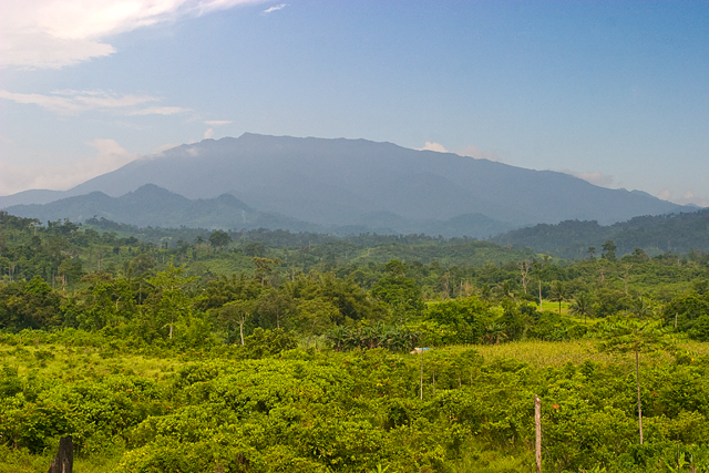
Mount Mantalingajan (or Mantalingahan or Mantaling) is the highest mountain in the island province of Palawan in the Philippines, with an elevation of 6,844 ft (2,086 m) above sea level, its ranked 68th-highest peak of an island on Earth and 10th-most prominent mountain in the Philippines. Located in the southern part of Palawan Island that forms the highest part of the Beaufort Mountains Ultramafics geological region, a series of ultramafic outcrops of Eocene origin, of which Mount Victoria forms the largest contiguous land area. The peak of the mountain is the highest point on Palawan island. The mountain forms the center of the Mount Mantalingahan Protected Landscape (MMPL), a national park covering the entire Mantalingahan Mountain Range. The protected area status of MMPL was proclaimed on June 23, 2009, by virtue of Proclamation No. 1815. The protected area covers an area of 120,457 hectares (1,204.57 km2). The entire park is currently listed as a tentative site for UNESCO World
Elevation: 2086 m
Country: Southeast Asia
Explore topics:
- Mount Mantalingajan hiking routes
- Mount Mantalingajan best routes
- Mount Mantalingajan camping
- Mount Mantalingajan parking
- Mount Mantalingajan car park
- Mount Mantalingajan difficulty
- Mount Mantalingajan family friendly
- Mount Mantalingajan dog friendly
- Mount Mantalingajan sunrise hike
- Mount Mantalingajan sunset hike
Related mountains in Southeast Asia
- Abel's Peak
- Abongabong Peak
- Abuno Peak
- Addison Peak
- Agupalon Ridge
- Andrew N. Nelson Hill
- Atimbia
- B'Nom Hù
- B'Nom Nam Bong
- Baktutan Peak