Gunung Tambora
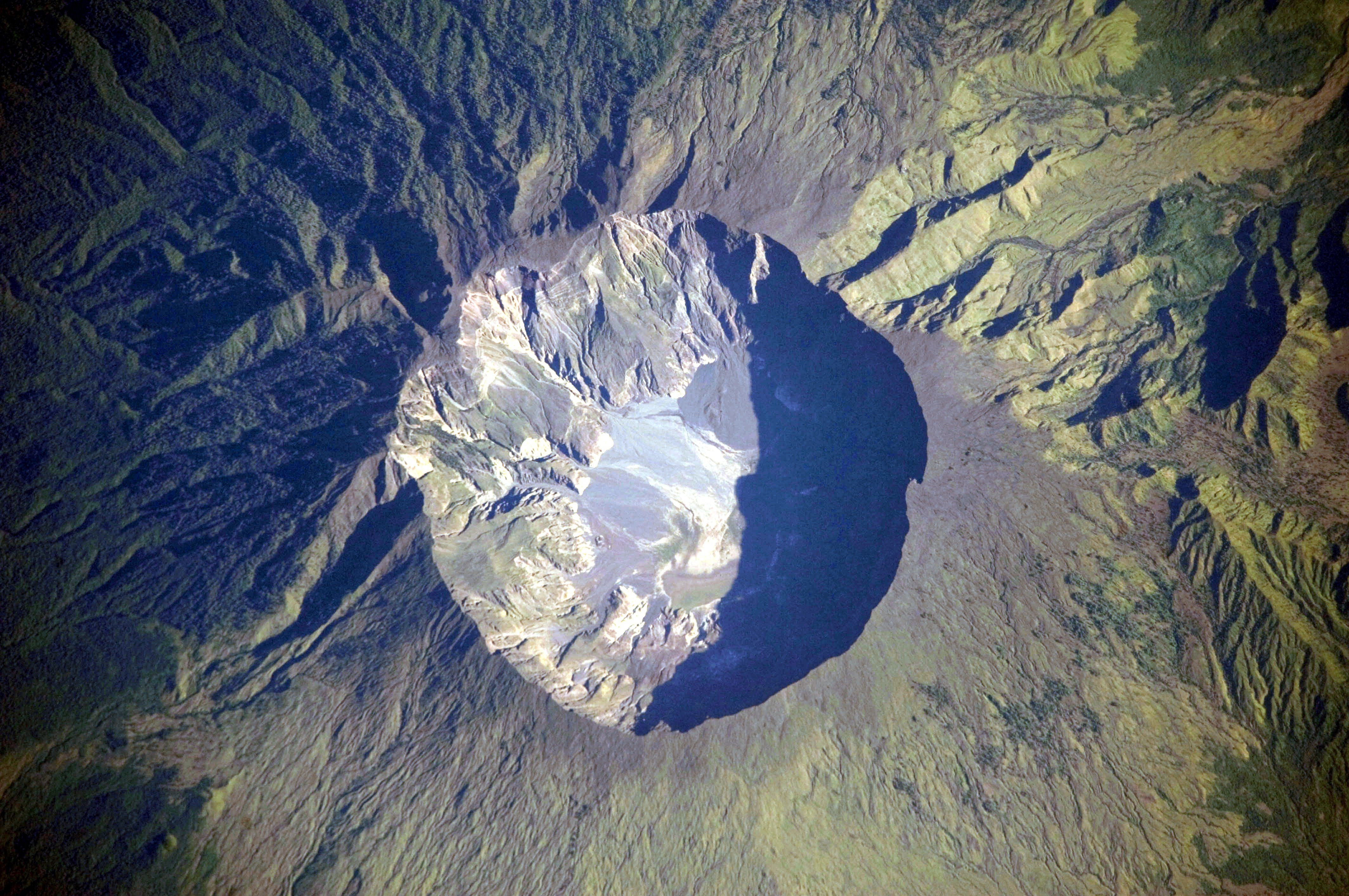
Mount Tambora, or Tomboro, is an active stratovolcano in West Nusa Tenggara, Indonesia. Located on Sumbawa in the Lesser Sunda Islands, it was formed by the active subduction zones beneath it. Before the 1815 eruption, its elevation reached more than 4,300 metres (14,100 feet) high, making it one of the tallest peaks in the Indonesian archipelago. Tambora underwent a series of violent eruptions, beginning on 5 April 1815, and culminating in the largest eruption in recorded human history. The magma chamber under Tambora had been drained by previous eruptions and lay dormant for several centuries as it refilled. Volcanic activity reached a peak that year, culminating in an explosive eruption that was heard on Sumatra island, more than 2,600 kilometres (1,600 mi) away and possibly over 3,350 kilometres (2,080 mi) away in Thailand and Laos. Heavy volcanic ash rains were observed as far away as Borneo, Sulawesi, Java, and Maluku islands, and the maximum elevation of Tambora was reduced fro
Elevation: 2690 m
Country: Pacific Islands
Explore topics:
- Gunung Tambora hiking routes
- Gunung Tambora best routes
- Gunung Tambora camping
- Gunung Tambora parking
- Gunung Tambora car park
- Gunung Tambora difficulty
- Gunung Tambora family friendly
- Gunung Tambora dog friendly
- Gunung Tambora sunrise hike
- Gunung Tambora sunset hike